
APRS (Automatic Packet Reporting System)
APRS is a system developed by Bob Bruninga, WB4APR, to use amateur radio to transimit geographic position reports, weather reports and to send and received messages between users. The APRS system utilizes digital packet radio technology to allow amateur radio stations to exchange information. The APRS information is also available via the internet.
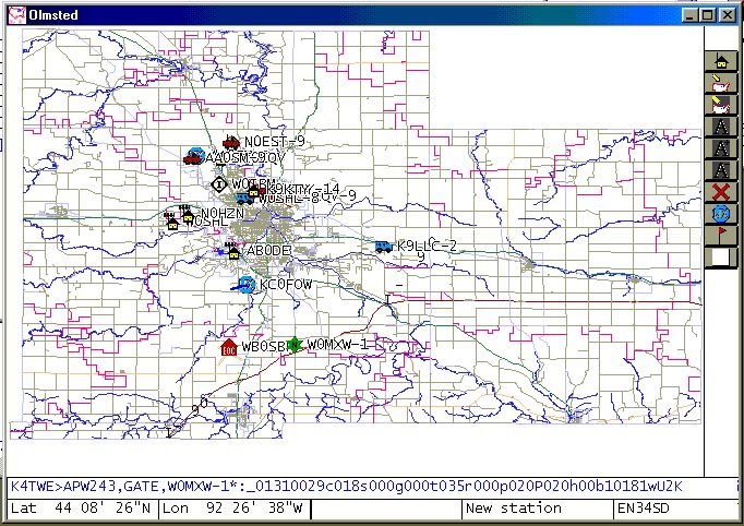 Rochester APRS stations shown on a screen image map of Olmsted County, Minnesota. Click on graphic to view a larger image. (WinAPRS image provided by Bob, NØEST.) |
APRS activity in Rochester has grown rapidly over the past couple of years through the leadership of Tony, AAØSM, Bob, NØEST, John NØHZN and others.
The RARC club operates a WIDE digipeater on the national APRS frequency of 144.39 Mhz. The digipeater, WØMXW-1, is located one mile east of the Rochester airport at Simpson and provides excellent coverage throughout the southeast Minnesota area. A second RELAY digipeater, WØMXW-2, is located at Assisi Heights in northwest Rochester. (Note: The WØMXW-2 digipeater was taken off the air in mid-August, 2004, and will remain off until a new site is found.).
The IBM Radio Club operates an internet gateway node (IGATE) digipeater using the call WØIBM.
With several amateur radio stations active on APRS in the Rochester area, the technology is being used to support local public service events and emergency service activities.
| Note: Rochester APRS users are requested to use the packet path WIDE1-1,WIDE2-2. The club digipeaters are being updated to no longer repeat packets with the old RELAY,WIDE packet path specification. For additional information on this change, see APRS Update. |
|
Real-time APRS map of Rochester, Minnesota |
NOTE: The map functions require that cookies be enabled in your browser.
Check out the following links for information on APRS.
APRS Web Links
http://web.usna.navy.mil/~bruninga/aprs.html
http://www.findu.com
http://www.tapr.org
http:www.dididahdahdidit.com
http://www.big.or.jp/~karl/data
http://wes.johnston.net/aprs
http://home.wi.rr.com/n9uur
http://www.winaprs.org
http://www.tapr.org/~kh2z/aprsplus/
http://www.projectx.com
http://www.ew.usna.edu/~bruninga/pcsat.html
http://web.usna.navy.mil/~bruninga/d700-faq.txt
http://www.ui-view.org
http://www.apritch.myby.co.uk/uiview.htm
APRS Data Via The Internet
Current WX Information:
Last update: January 9, 2010